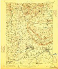
1905 Map of Somerville
USGS Topo · Published 1910About this map
The Raritan River and its numerous tributaries dominate this early 20th-century landscape, illustrating the complex water-power and transportation network of central New Jersey. The confluence of the North Branch Raritan River and the South Branch Raritan River defines the western approach to the county seat at Somerville. Industrial and infrastructure development is evident in the Water Power Cos. Raceway near the main river channel and the critical path of the Delaware and Raritan Canal near South Boundbrook.
Find a feature on this map
101 named features on this map. Tap any name to fly to it.
Don’t see what you’re looking for? This feature index may not catch every label — zoom into the map to look around manually.
Map Details
Editions of this 1905 Somerville Map
3 editions found
Other maps of this area

1888 · Plainfield
USGS Topo · 1:62,500

1888 · Morristown
USGS Topo · 1:62,500

1888 · Hackettstown
USGS Topo · 1:62,500

1888 · New Brunswick
USGS Topo · 1:62,500

1888 · Princeton
USGS Topo · 1:62,500

1888 · Lake Hopatcong
USGS Topo · 1:62,500

1890 · High Bridge
USGS Topo · 1:62,500

1890 · Lambertville
USGS Topo · 1:62,500

1891 · Somerville
USGS Topo · 1:62,500

1891 · Lambertville
USGS Topo · 1:62,500
Featured Places
- Franklin Township, NJ
- Piscataway Township, NJ
- Bridgewater Township, NJ
- Hillsborough Township, NJ
- Readington Township, NJ