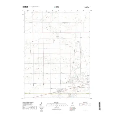
2021 Map of Somonauk
USGS Topo · Published 2021About this map
Sandwich and Somonauk anchor the southern landscape of this northern Illinois region, where the boundary between DeKalb and LaSalle counties crosses through agricultural land. The terrain is defined by the winding course of Somonauk Creek, which feeds into the recreational waters of Lake Holiday near Woodlake Landing. This contemporary survey reflects the enduring rural structure of the area, punctuated by small aviation landmarks like George Airport and the tiny community of Franks further north.
Find a feature on this map
70 named features on this map. Tap any name to fly to it.
Don’t see what you’re looking for? This feature index may not catch every label — zoom into the map to look around manually.
Map Details
Editions of this 2021 Somonauk Map
This is the sole edition of this map. No revisions or reprints were ever made.
Other maps of this area

1934 · De Kalb
USGS Topo · 1:62,500

1937 · De Kalb
USGS Topo · 1:62,500

1937 · Sycamore
USGS Topo · 1:62,500

1948 · Sandwich
USGS Topo · 1:62,500

1950 · Sandwich
USGS Topo · 1:62,500

1951 · Earlville
USGS Topo · 1:62,500

1958 · Aurora
USGS Topo · 1:250,000

1961 · Aurora
USGS Topo · 1:250,000
1968 · Big Rock
USGS Topo · 1:24,000
1968 · Hinckley
USGS Topo · 1:24,000