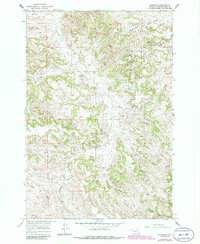
1966 Map of Sonnette
USGS Topo · Published 1986About this map
Pumpkin Creek carves a central path through this section of Powder River County, anchoring a landscape defined by isolated homesteads and ranching outposts. The small settlement of Sonnette sits near the confluence of local drainages, serving as a focal point for the surrounding rural population. Educational and industrial footprints are modest but significant, represented by the Mitchell Sch and the Two Tree Mine located near Two Tree Creek. The terrain is marked by numerous water sources essential for high-plains survival, including Chuffey Spring, Buck Spring, and various unnamed Springs. These features, alongside named locations like Doonan and Skinner, illustrate the scattered nature of mid-century Montana settlement patterns, where life revolved around available water and the rugged topography of the gulches and runs.
Find a feature on this map
22 named features on this map. Tap any name to fly to it.
Don’t see what you’re looking for? This feature index may not catch every label — zoom into the map to look around manually.
Map Details
Editions of this 1966 Sonnette Map
2 editions found
Other maps of this area

1954 · Ekalaka
USGS Topo · 1:250,000

1956 · Ekalaka
USGS Topo · 1:250,000

1958 · Ekalaka
USGS Topo · 1:250,000

1965 · Ekalaka
USGS Topo · 1:250,000

1966 · Sonnette
USGS Topo · 1:24,000

1966 · Home Creek Butte
USGS Topo · 1:24,000

1966 · Phillips Butte
USGS Topo · 1:24,000

1966 · Hodsdon Flats
USGS Topo · 1:24,000

1966 · Threemile Buttes
USGS Topo · 1:24,000

1966 · Samuelson Ranch
USGS Topo · 1:24,000