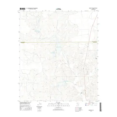
2016 Map of Sonora NW
USGS Topo · Published 2016About this map
Dry Devils River carves a winding path through the Edwards Plateau, dominating the landscape where the Schleicher Co and Sutton Co line meets. This 2016 survey highlights a sophisticated network of water management infrastructure, specifically the numerous reservoirs built by the Soil Conservation Service. These features, including Soil Conservation Service Site 2 Reservoir, Soil Conservation Service Site 3 Reservoir, and Soil Conservation Service Site 4 Reservoir, are strategically placed to capture runoff in this semi-arid region.
Find a feature on this map
20 named features on this map. Tap any name to fly to it.
Don’t see what you’re looking for? This feature index may not catch every label — zoom into the map to look around manually.
Map Details
Editions of this 2016 Sonora NW Map
This is the sole edition of this map. No revisions or reprints were ever made.
Other maps of this area

1954 · Sonora
USGS Topo · 1:250,000

1958 · Sonora
USGS Topo · 1:250,000

1964 · Sonora
USGS Topo · 1:24,000

1964 · Sonora SE
USGS Topo · 1:24,000

1964 · Sonora NE
USGS Topo · 1:24,000

1964 · Eldorado SW
USGS Topo · 1:24,000

1964 · Sonora NW
USGS Topo · 1:24,000

1964 · Coupe Ranch
USGS Topo · 1:24,000
1964 · Eldorado
USGS Topo · 1:24,000

1967 · Savell Ranch
USGS Topo · 1:24,000