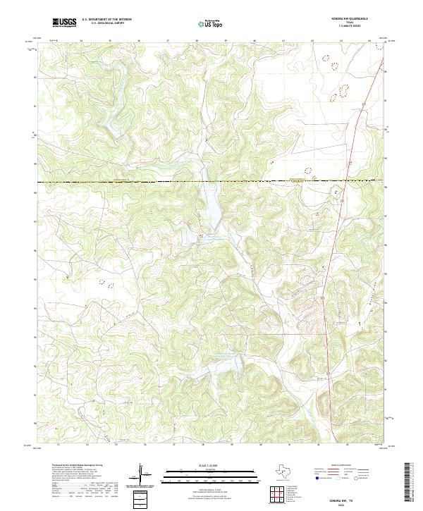
2022 Map of Sonora NW
USGS Topo · Published 2022About this map
The Dry Devils River carves a significant course through this landscape, marking the transition across the Schleicher Co and Sutton Co line in west-central Texas. This 2022 survey documents a rugged ranching terrain defined by deep draws and water management infrastructure, most notably the Soil Conservation Service Site 4 Reservoir and Soil Conservation Service-Site 7 Reservoir. These reservoirs, along with the drainage of Meckel Draw, illustrate the region's historical reliance on seasonal water catchments in an arid environment. The map shows a network of private and county roads, such as Co RD 102 and PVT RD 1158, that provide access to the remote interior ranch lands and livestock operations that have long characterized this part of the Edwards Plateau.
Find a feature on this map
18 named features on this map. Tap any name to fly to it.
Don’t see what you’re looking for? This feature index may not catch every label — zoom into the map to look around manually.
Map Details
Editions of this 2022 Sonora NW Map
This is the sole edition of this map. No revisions or reprints were ever made.
Other maps of this area

1954 · Sonora
USGS Topo · 1:250,000

1958 · Sonora
USGS Topo · 1:250,000

1964 · Sonora
USGS Topo · 1:24,000

1964 · Sonora SE
USGS Topo · 1:24,000

1964 · Sonora NE
USGS Topo · 1:24,000

1964 · Eldorado SW
USGS Topo · 1:24,000

1964 · Sonora NW
USGS Topo · 1:24,000

1964 · Coupe Ranch
USGS Topo · 1:24,000
1964 · Eldorado
USGS Topo · 1:24,000

1967 · Savell Ranch
USGS Topo · 1:24,000