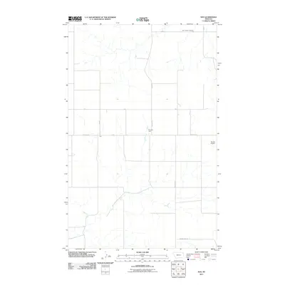
2011 Map of Soo
USGS Topo · Published 2011About this map
The small settlement of Soo anchors this section of Roosevelt County, Montana, characterized by the expansive agricultural landscape and a network of gravel section roads. The rural character of the area is defined by features like the Faith Lutheran Cemetery in the northern reaches and Bummer Dam situated along Welliver Rd. These landmarks speak to the endurance of early 20th-century homesteading communities and the critical importance of water management in the northern plains. The drainage of Burshia Coulee and the winding path of Smoke Creek further illustrate the topographic relief that local ranchers and farmers have navigated for generations. Roads like 3 Corners Rd and Medicine Lake Rd connect this isolated agricultural district, providing a clear view of the rural infrastructure at the beginning of the 21st century.
Find a feature on this map
16 named features on this map. Tap any name to fly to it.
Don’t see what you’re looking for? This feature index may not catch every label — zoom into the map to look around manually.
Map Details
Editions of this 2011 Soo Map
This is the sole edition of this map. No revisions or reprints were ever made.
Other maps of this area

1909 · Smoke Creek
USGS Topo · 1:62,500

1912 · Hay Creek
USGS Topo · 1:62,500

1912 · Smoke Creek
USGS Topo · 1:62,500

1954 · Wolf Point
USGS Topo · 1:250,000

1958 · Wolf Point
USGS Topo · 1:250,000

1973 · Pleasant Prairie
USGS Topo · 1:24,000

1973 · Pleasant Prairie NE
USGS Topo · 1:24,000

1982 · Culbertson
USGS Topo · 1:100,000
1983 · Hay Creek
USGS Topo · 1:24,000
1983 · Smoke Creek NE
USGS Topo · 1:24,000