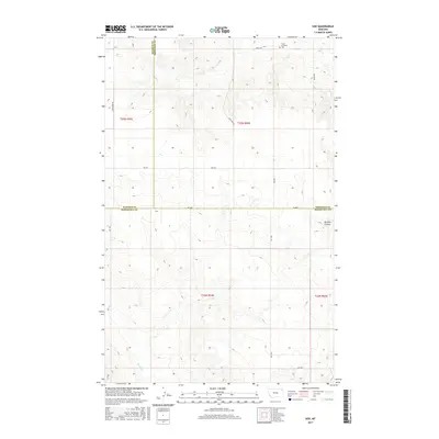
2017 Map of Soo
USGS Topo · Published 2017About this map
Soo is situated at a rare three-county junction in northeastern Montana, where the boundaries of Sheridan, Daniels, and Roosevelt counties converge. The landscape is defined by the high plains drainage of Smoke Creek and the meandering path of Burshia Coulee to the east. This 2017 survey reveals a rural infrastructure built around a grid of section-line roads, including Risa Road and Welliver Road, which connect isolated homesteads and ranching interests across the rolling terrain.
Find a feature on this map
20 named features on this map. Tap any name to fly to it.
Don’t see what you’re looking for? This feature index may not catch every label — zoom into the map to look around manually.
Map Details
Editions of this 2017 Soo Map
This is the sole edition of this map. No revisions or reprints were ever made.
Other maps of this area

1909 · Smoke Creek
USGS Topo · 1:62,500

1912 · Hay Creek
USGS Topo · 1:62,500

1912 · Smoke Creek
USGS Topo · 1:62,500

1954 · Wolf Point
USGS Topo · 1:250,000

1958 · Wolf Point
USGS Topo · 1:250,000

1973 · Pleasant Prairie
USGS Topo · 1:24,000

1973 · Pleasant Prairie NE
USGS Topo · 1:24,000

1982 · Culbertson
USGS Topo · 1:100,000
1983 · Hay Creek
USGS Topo · 1:24,000
1983 · Smoke Creek NE
USGS Topo · 1:24,000