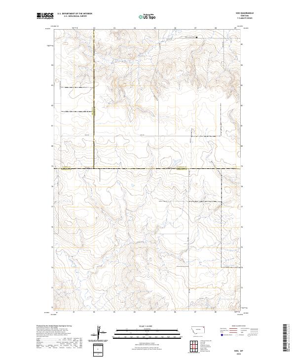
2024 Map of Soo
USGS Topo · Published 2024About this map
Faith Lutheran Cem sits near the northern boundary of this High Plains landscape, serving as a localized historical marker where Wanso Rd and Welliver Rd traverse the prairie. The terrain is defined by the drainage patterns of Smoke Creek in the southwest and the winding Burshia Coulee to the east, illustrating the complex erosional geography of the region. This 2024 survey captures a unique triple-border intersection where Roosevelt, Sheridan, and Daniels Counties meet. The road network, including Risa Rd and Rd 2030, follows the traditional Public Land Survey System grid, reflecting the long-standing agricultural and ranching divisions of the Montana borderlands.
Find a feature on this map
18 named features on this map. Tap any name to fly to it.
Don’t see what you’re looking for? This feature index may not catch every label — zoom into the map to look around manually.
Map Details
Editions of this 2024 Soo Map
This is the sole edition of this map. No revisions or reprints were ever made.
Other maps of this area

1909 · Smoke Creek
USGS Topo · 1:62,500

1912 · Hay Creek
USGS Topo · 1:62,500

1912 · Smoke Creek
USGS Topo · 1:62,500

1954 · Wolf Point
USGS Topo · 1:250,000

1958 · Wolf Point
USGS Topo · 1:250,000

1973 · Pleasant Prairie
USGS Topo · 1:24,000

1973 · Pleasant Prairie NE
USGS Topo · 1:24,000

1982 · Culbertson
USGS Topo · 1:100,000
1983 · Hay Creek
USGS Topo · 1:24,000
1983 · Smoke Creek NE
USGS Topo · 1:24,000