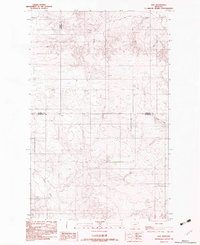
1983 Map of Soo
USGS Topo · Published 1983About this map
Soo sits at the convergence of three northeastern Montana counties in this 1983 provisional survey. The landscape is defined by the drainage patterns of the high plains, specifically where Smoke Creek and Burshia Coulee carve through the terrain. The map captures a transition point where the boundaries of Daniels, Sheridan, and Roosevelt counties meet. This survey provides a precise record of the road network and section lines as they existed in the early 1980s, reflecting the sparse settlement patterns and topography of the Fort Peck Indian Reservation region during this era.
Find a feature on this map
6 named features on this map. Tap any name to fly to it.
Don’t see what you’re looking for? This feature index may not catch every label — zoom into the map to look around manually.
Map Details
Editions of this 1983 Soo Map
This is the sole edition of this map. No revisions or reprints were ever made.
Other maps of this area

1909 · Smoke Creek
USGS Topo · 1:62,500

1912 · Hay Creek
USGS Topo · 1:62,500

1912 · Smoke Creek
USGS Topo · 1:62,500

1954 · Wolf Point
USGS Topo · 1:250,000

1958 · Wolf Point
USGS Topo · 1:250,000

1973 · Pleasant Prairie
USGS Topo · 1:24,000

1973 · Pleasant Prairie NE
USGS Topo · 1:24,000

1982 · Culbertson
USGS Topo · 1:100,000
1983 · Hay Creek
USGS Topo · 1:24,000
1983 · Smoke Creek NE
USGS Topo · 1:24,000