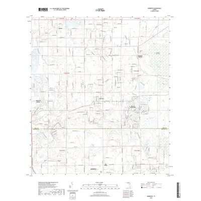
2018 Map of Sorrento
USGS Topo · Published 2018About this map
Seminole Springs and the surrounding Lake County landscape show a mix of established citrus-era settlements and expanding residential communities just north of Apopka. The map illustrates the varied hydrology of the region, featuring numerous solution-hole lakes such as Lake Seneca, Lake of the Woods, and Mount Plymouth Lake. These water bodies, along with the flowing Rock Springs Run and Seminole Creek, have long defined the settlement patterns of towns like Sorrento and Mount Plymouth.
Find a feature on this map
201 named features on this map. Tap any name to fly to it.
Don’t see what you’re looking for? This feature index may not catch every label — zoom into the map to look around manually.
Map Details
Editions of this 2018 Sorrento Map
This is the sole edition of this map. No revisions or reprints were ever made.
Other maps of this area

1955 · Orlando
USGS Topo · 1:250,000

1957 · Orlando
USGS Topo · 1:250,000

1958 · Orlando
USGS Topo · 1:250,000

1959 · Forest City
USGS Topo · 1:24,000

1960 · Sorrento
USGS Topo · 1:24,000

1960 · Apopka
USGS Topo · 1:24,000

1962 · Orlando
USGS Topo · 1:250,000

1962 · Pine Lakes
USGS Topo · 1:24,000

1962 · Astatula
USGS Topo · 1:24,000
1965 · Sanford SW
USGS Topo · 1:24,000