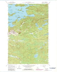
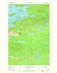
1956 Map of Soudan
USGS Topo · Published 1986About this map
Soudan Mine and the adjacent town of Soudan anchor this portion of the Vermilion Range, where iron mining shaped the landscape and economy well into the mid-20th century. The intricate shoreline of Lake Vermilion dominates the north, characterized by numerous islands like Timber Island and Hendrickson Island. The industrial footprint of the Duluth Missabe and Iron Range railroad is clearly visible, providing the essential transport link between the mines and southern ports. Much of the southern terrain is dedicated to the Bear Island State Forest, a dense wilderness of lakes and creeks including Putnam Lake and Skeleton Lake. Within Tower Soudan State Park, Jasper Peak stands as a prominent landmark with its Lookout Tower, marking the transition between the extractive industrial sites and the preserved natural spaces of northern Minnesota.
Find a feature on this map
49 named features on this map. Tap any name to fly to it.
Don’t see what you’re looking for? This feature index may not catch every label — zoom into the map to look around manually.
Map Details
Editions of this 1956 Soudan Map
5 editions found
Other maps of this area

1949 · Isaac Lake
USGS Topo · 1:24,000

1949 · Embarrass
USGS Topo · 1:24,000

1950 · Isaac Lake
USGS Topo · 1:24,000

1950 · Embarrass
USGS Topo · 1:24,000

1950 · Biwabik NE
USGS Topo · 1:24,000

1951 · Biwabik NE
USGS Topo · 1:24,000

1954 · Hibbing
USGS Topo · 1:250,000

1956 · Sioux Pine Island
USGS Topo · 1:24,000

1956 · Tower
USGS Topo · 1:24,000

1956 · Chad Lake
USGS Topo · 1:24,000