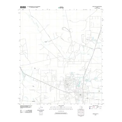
2010 Map of Sour Lake
USGS Topo · Published 2010About this map
The Sour Lake Dome Oil Field defines the industrial landscape of this Hardin County region, marking a legacy of petroleum extraction that shaped the town of Sour Lake. The settlement is situated amidst a network of natural water systems, including The Sour Lakes and the meandering course of Little Pine Island Bayou. To the west, the open reaches of Jones Prairie and Pelt Prairie provide a glimpse into the traditional coastal prairie terrain before it transitions into more developed areas and timberlands.
Find a feature on this map
35 named features on this map. Tap any name to fly to it.
Don’t see what you’re looking for? This feature index may not catch every label — zoom into the map to look around manually.
Map Details
Editions of this 2010 Sour Lake Map
This is the sole edition of this map. No revisions or reprints were ever made.
Other maps of this area

1943 · Liberty
USGS Topo · 1:125,000

1954 · Beaumont
USGS Topo · 1:250,000

1955 · Daisetta
USGS Topo · 1:62,500

1955 · Saratoga
USGS Topo · 1:62,500

1955 · Kountze
USGS Topo · 1:62,500

1955 · Sour Lake
USGS Topo · 1:62,500

1957 · Beaumont
USGS Topo · 1:250,000

1984 · Beaumont
USGS Topo · 1:250,000
1984 · Nome
USGS Topo · 1:24,000

1984 · Sour Lake
USGS Topo · 1:24,000