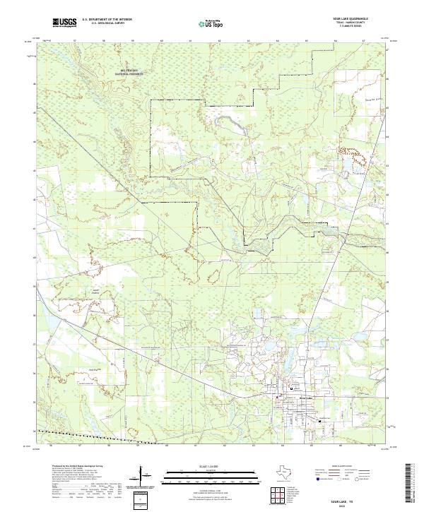
2022 Map of Sour Lake
USGS Topo · Published 2022About this map
Sour Lake serves as the primary hub for this portion of Hardin County, situated at the edge of the sprawling Big Thicket National Preserve. The landscape is a complex network of waterways, where Pine Island Bayou and Little Pine Island Bayou meet a system of smaller tributaries like Yearling Tick Br and Black Cr. These drainages define the boundaries of local clearings such as Jones Prairie and Pelt Prairie, which contrast with the dense timberlands traditional to this part of the Texas Gulf Coast.
Find a feature on this map
71 named features on this map. Tap any name to fly to it.
Don’t see what you’re looking for? This feature index may not catch every label — zoom into the map to look around manually.
Map Details
Editions of this 2022 Sour Lake Map
This is the sole edition of this map. No revisions or reprints were ever made.
Other maps of this area

1943 · Liberty
USGS Topo · 1:125,000

1954 · Beaumont
USGS Topo · 1:250,000

1955 · Daisetta
USGS Topo · 1:62,500

1955 · Saratoga
USGS Topo · 1:62,500

1955 · Kountze
USGS Topo · 1:62,500

1955 · Sour Lake
USGS Topo · 1:62,500

1957 · Beaumont
USGS Topo · 1:250,000

1984 · Beaumont
USGS Topo · 1:250,000
1984 · Nome
USGS Topo · 1:24,000

1984 · Sour Lake
USGS Topo · 1:24,000