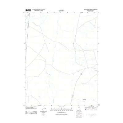
2012 Map of South Bastian Spring
USGS Topo · Published 2012About this map
South Bastian Spring serves as a focal point in this high-desert landscape of White Pine County, where water sources dictate the placement of local infrastructure. The drainage patterns of Spring Creek and Cleve Creek define the basin, while the presence of Osceola Arch to the southeast indicates the distinct geological formations found in this part of Nevada. This 2012 survey illustrates the sparse but critical network of rural routes, including Co Rd 37, which navigate the terrain between the open flats and the rising elevations of Turnley Canyon. The map provides a clear view of the relationship between these seasonal watercourses and the established transport corridors that have long connected this region's remote outposts.
Find a feature on this map
8 named features on this map. Tap any name to fly to it.
Don’t see what you’re looking for? This feature index may not catch every label — zoom into the map to look around manually.
Map Details
Editions of this 2012 South Bastian Spring Map
This is the sole edition of this map. No revisions or reprints were ever made.
Other maps of this area

1952 · Ely
USGS Topo · 1:125,000

1956 · Ely
USGS Topo · 1:250,000

1959 · Ely
USGS Topo · 1:250,000

1959 · Sacramento Pass
USGS Topo · 1:62,500

1959 · Connors Pass
USGS Topo · 1:62,500

1959 · Schell Peaks
USGS Topo · 1:62,500

1963 · Ely
USGS Topo · 1:250,000
1981 · Majors Place
USGS Topo · 1:24,000
1981 · South Schell Peak
USGS Topo · 1:24,000
1981 · Cave Mountain
USGS Topo · 1:24,000