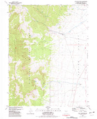
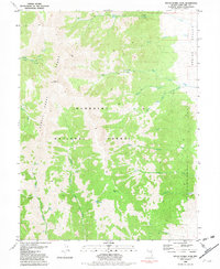
1981 Map of Cave Mountain
USGS Topo · Published 1982About this map
The Schell Creek Range dominates the western half of this 1981 survey, rising sharply above the flat expanse of Spring Valley. The landscape is defined by the transition from high-elevation peaks, including the prominent Cave Mountain, to the alluvial fans and drainage systems that feed the valley floor. Cleve Creek is a primary watercourse here, flowing past the Cleve Creek Campground and a designated Campsite before reaching a Gaging Station on the valley margin. This area within the Humboldt National Forest was actively managed for both recreation and resource extraction, as evidenced by scattered prospects and a Borrow Pit in the valley.
Find a feature on this map
31 named features on this map. Tap any name to fly to it.
Don’t see what you’re looking for? This feature index may not catch every label — zoom into the map to look around manually.
Map Details
Editions of this 1981 Cave Mountain Map
2 editions found
Other maps of this area

1952 · Ely
USGS Topo · 1:125,000

1956 · Ely
USGS Topo · 1:250,000

1959 · Ely
USGS Topo · 1:250,000

1959 · Sacramento Pass
USGS Topo · 1:62,500

1959 · Connors Pass
USGS Topo · 1:62,500

1959 · Schell Peaks
USGS Topo · 1:62,500

1963 · Ely
USGS Topo · 1:250,000
1981 · Connors Pass
USGS Topo · 1:24,000
1981 · Majors Place
USGS Topo · 1:24,000
1981 · South Schell Peak
USGS Topo · 1:24,000