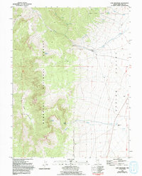
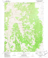
1981 Map of Cave Mountain
USGS Topo · Published 1994About this map
Cave Mountain dominates the landscape of the Schell Creek Range as it transitions into the broad expanse of Spring Valley. This 1981 survey, based on 1970s aerial photography, reveals the high-altitude terrain of the Humboldt National Forest, where water management and ranching define the local geography. Significant water features like Bastian Creek and an Aqueduct trace the eastern slopes, leading down toward the Bastian Creek Ranch. The map captures a moment in the region's land use, featuring the Cleve Creek Campground for recreation alongside a Radio Facility and several scattered Prospect sites that point to the area's mineral exploration history. Named points like Hanson and various springs, including Cottonwood Spring and Indian Springs, provide specific markers for genealogists and researchers tracking land ownership and rural settlement patterns in White Pine County.
Find a feature on this map
26 named features on this map. Tap any name to fly to it.
Don’t see what you’re looking for? This feature index may not catch every label — zoom into the map to look around manually.
Map Details
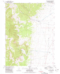
Editions of this 1981 Cave Mountain Map
2 editions found
Other maps of this area

1952 · Ely
USGS Topo · 1:125,000

1956 · Ely
USGS Topo · 1:250,000

1959 · Ely
USGS Topo · 1:250,000

1959 · Sacramento Pass
USGS Topo · 1:62,500

1959 · Connors Pass
USGS Topo · 1:62,500

1959 · Schell Peaks
USGS Topo · 1:62,500

1963 · Ely
USGS Topo · 1:250,000
1981 · Connors Pass
USGS Topo · 1:24,000
1981 · Majors Place
USGS Topo · 1:24,000
1981 · South Schell Peak
USGS Topo · 1:24,000