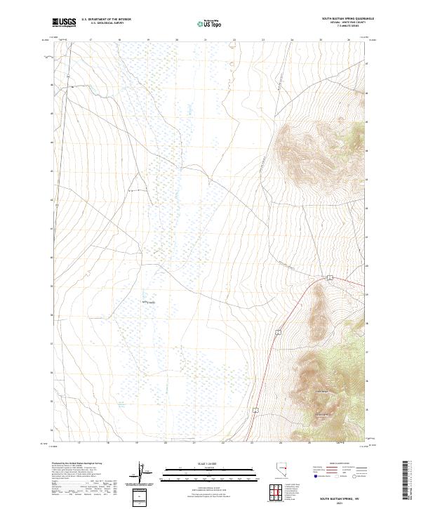
2021 Map of South Bastian Spring
USGS Topo · Published 2021About this map
Spring Valley dominates this eastern Nevada landscape, where the wide basin floor meets the rising elevations of the Snake Range. The hydrology of the valley is defined by its namesake springs and intermittent drainages like Cleve Cr which flow from the higher terrain to the west. A notable geological feature, the Osceola Arch, sits on the western flank of the range, highlighting the unique limestone and quartzite formations of the district. Human infrastructure is relatively sparse, represented primarily by White Pine Co Road 37 and 6 50, which facilitate movement between the basin's ranching interests and the rugged eastern peaks. At the heart of the lower terrain, the namesake South Bastian Spring serves as a vital water source in this arid environment, illustrating the critical role of groundwater for settlement and livestock in the high desert.
Find a feature on this map
13 named features on this map. Tap any name to fly to it.
Don’t see what you’re looking for? This feature index may not catch every label — zoom into the map to look around manually.
Map Details
Editions of this 2021 South Bastian Spring Map
This is the sole edition of this map. No revisions or reprints were ever made.
Other maps of this area

1952 · Ely
USGS Topo · 1:125,000

1956 · Ely
USGS Topo · 1:250,000

1959 · Ely
USGS Topo · 1:250,000

1959 · Sacramento Pass
USGS Topo · 1:62,500

1959 · Connors Pass
USGS Topo · 1:62,500

1959 · Schell Peaks
USGS Topo · 1:62,500

1963 · Ely
USGS Topo · 1:250,000
1981 · Majors Place
USGS Topo · 1:24,000
1981 · South Schell Peak
USGS Topo · 1:24,000
1981 · Cave Mountain
USGS Topo · 1:24,000