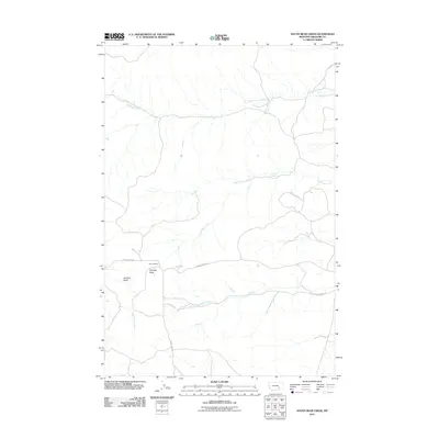
2011 Map of South Bear Creek
USGS Topo · Published 2011About this map
West Bear Creek and South Bear Creek carve through the arid high plains of Treasure County in this drainage basin overview. The landscape is defined by its water sources and prominent high points, including the distinct formations of Whiskey Butte and Bulldog Butte. Human presence is sparse, centered on the Barnes Ranch and a network of arterial roads like Burnt Creek Rd and Iron Spring Rd that follow the natural contours of the land. Key landmarks such as Barrot Spring highlight the critical importance of water in this ranching country. The arrangement of seasonal waterways like Crystal Creek and East Burnt Creek reveals a terrain shaped by erosion, where transportation routes and property boundaries are dictates by the breaks and coulees of the Montana prairie.
Find a feature on this map
13 named features on this map. Tap any name to fly to it.
Don’t see what you’re looking for? This feature index may not catch every label — zoom into the map to look around manually.
Map Details
Editions of this 2011 South Bear Creek Map
This is the sole edition of this map. No revisions or reprints were ever made.
Other maps of this area

1954 · Hardin
USGS Topo · 1:250,000

1954 · Forsyth
USGS Topo · 1:250,000

1957 · Hardin
USGS Topo · 1:250,000

1957 · Forsyth
USGS Topo · 1:250,000

1958 · Forsyth
USGS Topo · 1:250,000

1958 · Hardin
USGS Topo · 1:250,000

1960 · Eldering Ranch
USGS Topo · 1:24,000

1960 · Hope Ranch
USGS Topo · 1:24,000

1972 · Hammond Ranch
USGS Topo · 1:24,000

1972 · Minnehaha Creek South
USGS Topo · 1:24,000