Loading...
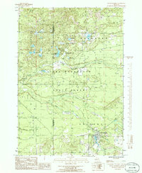
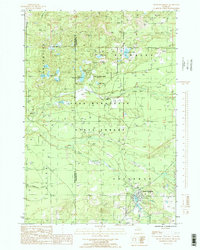
Loading map...1985 Map of South Boardman
USGS Topo · Published 1986About this map
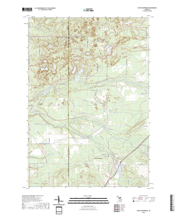
South Boardman sits at the convergence of several waterways in the mid-1980s, where the South Branch Boardman River and Shannon Cr meet. This portion of the Pere Marquette State Forest is defined by a dense network of glacial kettle lakes and wetlands, including the cluster of Sand Lakes, Guernsey Lake, and Island Lake. The landscape reflects a mix of conservation and extraction, with a Sand Pit and Gravel Pit located near the riverbanks.
Find a feature on this map
29 named features on this map. Tap any name to fly to it.
Don’t see what you’re looking for? This feature index may not catch every label — zoom into the map to look around manually.
Map Details
Date Portrayed1985
Date Published1986
PublisherU.S. Geological Survey
Map TypeTopographic
Scale1:24,000
Physical Dimensions21.9 x 26.8 inches
Editions of this 1985 South Boardman Map
2 editions found
Historical Maps of Whitewater Township Through Time
6 maps found
Featured Locations
- Union Township, MI
- Whitewater Township, MI
- Boardman Township, MI
- Kalkaska Township, MI
- South Boardman, Boardman Township
Source Details
SourceU.S. Geological Survey
CopyrightPublic Domain