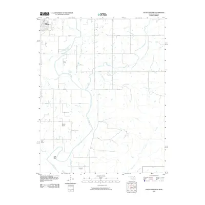
2010 Map of South Coffeyville
USGS Topo · Published 2010About this map
The Verdigris River snakes through the borderlands of Oklahoma and Kansas, carving a prominent oxbow at Goose Neck Bend south of the state line. This 2010 topographic survey documents the rural landscape surrounding South Coffeyville, where a network of county roads follows the section lines of the Cherokee Outlet. For genealogists, the map identifies several local burial grounds, including Melton Cemetery and Hickory Creek Cemetery, as well as the remote Goose Neck Cemetery near the river's edge.
Find a feature on this map
39 named features on this map. Tap any name to fly to it.
Don’t see what you’re looking for? This feature index may not catch every label — zoom into the map to look around manually.
Map Details
Editions of this 2010 South Coffeyville Map
This is the sole edition of this map. No revisions or reprints were ever made.
Other maps of this area

1886 · Independence
USGS Topo · 1:125,000

1886 · Parsons
USGS Topo · 1:125,000

1893 · Parsons
USGS Topo · 1:125,000

1894 · Independence
USGS Topo · 1:125,000

1901 · Nowata
USGS Topo · 1:125,000

1901 · Vinita
USGS Topo · 1:125,000

1905 · Independence
USGS Topo · 1:125,000

1913 · Vinita
USGS Topo · 1:125,000

1914 · Nowata
USGS Topo · 1:125,000

1946 · Mound Valley
USGS Topo · 1:62,500