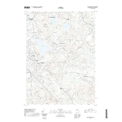
2021 Map of South Groveland
USGS Topo · Published 2021About this map
Haverhill and South Groveland anchor this modern landscape of glacial ponds and historic hills along the Merrimack River. The map highlights a transition from suburban development to protected open space, with several notable rail trails including the Essex Railroad Rail Trl and the Border-To-Boston Trl following historical transportation corridors. Genealogists will find the Smallpox Burial Ground and the First Burying Ground in North Andover Center to be of particular interest, reflecting the long-established burial traditions of Essex County. The geography is dominated by numerous water bodies such as Lake Cochichewick and Johnsons Pond, interspersed with family-named peaks like Barker Hill and Osgood Hill. Regional infrastructure is well-represented, from Merrimack College to the Lawrence Municipal Airport on the western edge of the quadrangle.
Find a feature on this map
75 named features on this map. Tap any name to fly to it.
Don’t see what you’re looking for? This feature index may not catch every label — zoom into the map to look around manually.
Map Details
Editions of this 2021 South Groveland Map
This is the sole edition of this map. No revisions or reprints were ever made.
Other maps of this area

1886 · Lawrence
USGS Topo · 1:62,500

1888 · Newburyport
USGS Topo · 1:62,500

1888 · Haverhill
USGS Topo · 1:62,500

1888 · Lawrence
USGS Topo · 1:62,500

1888 · Salem
USGS Topo · 1:62,500

1890 · Haverhill
USGS Topo · 1:62,500

1890 · Newburyport
USGS Topo · 1:62,500

1893 · Salem
USGS Topo · 1:62,500

1893 · Lawrence
USGS Topo · 1:62,500

1893 · Haverhill
USGS Topo · 1:62,500