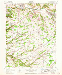
1955 Map of South Lebanon
USGS Topo · Published 1968About this map
The Little Miami River corridor defines the landscape of this southern Ohio region, where the Penn Central and Baltimore and Ohio railroads converge near Middletown Junction. The mid-century topography reveals a mix of established villages and industrial footprints, notably the U S Military Reservation (Ordnance Plant) situated near Kings Mills. This map captures a significant period of local development, showing the transition from traditional farming communities like Maineville and Dallasburg to more modern land uses, such as a Golf Course and several gravel pits, while preserving the location of early rural infrastructure like the Township School.
Find a feature on this map
65 named features on this map. Tap any name to fly to it.
Don’t see what you’re looking for? This feature index may not catch every label — zoom into the map to look around manually.
Map Details
Editions of this 1955 South Lebanon Map
4 editions found
Other maps of this area

1898 · East Cincinnati
USGS Topo · 1:62,500

1904 · Mason
USGS Topo · 1:62,500

1906 · Mason
USGS Topo · 1:62,500

1914 · East Cincinnati
USGS Topo · 1:62,500

1914 · Batavia
USGS Topo · 1:48,000

1914 · Morrow
USGS Topo · 1:62,500

1916 · Batavia
USGS Topo · 1:62,500

1916 · Morrow
USGS Topo · 1:62,500

1953 · Goshen
USGS Topo · 1:24,000

1953 · Newtonsville
USGS Topo · 1:24,000