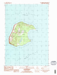
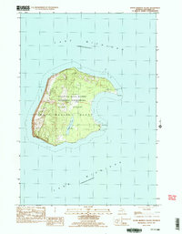
1983 Map of South Manitou Island
USGS Topo · Published 1984About this map
South Manitou Island is documented here as part of the Sleeping Bear Dunes National Lakeshore during the late 1970s and early 1980s. The landscape is defined by its massive Perched Dunes along the western shore and the protected waters of the bay to the east. Maritime history is central to this location, marked by the S Manitou Lighthouse at Sandy Point and a noted Shipwreck off the southern coast. Near the center of the island, Florence Lake provides a rare freshwater feature, while the presence of the S Manitou Cem speaks to the island's earlier resident community. Navigation across the interior is shown via the 10 Foot Trail, connecting various Campground sites and the historic Docks.
Find a feature on this map
15 named features on this map. Tap any name to fly to it.
Don’t see what you’re looking for? This feature index may not catch every label — zoom into the map to look around manually.
Map Details
Editions of this 1983 South Manitou Island Map
3 editions found
Other maps of this area

1954 · Escanaba
USGS Topo · 1:250,000

1954 · Manitowoc
USGS Topo · 1:250,000

1956 · North Manitou
USGS Topo · 1:62,500

1957 · Escanaba
USGS Topo · 1:250,000

1957 · Empire
USGS Topo · 1:62,500

1958 · Escanaba
USGS Topo · 1:250,000

1958 · Manitowoc
USGS Topo · 1:250,000
1983 · Glen Haven
USGS Topo · 1:25,000
1983 · North Manitou Island
USGS Topo · 1:25,000
1983 · South Manitou Island
USGS Topo · 1:24,000