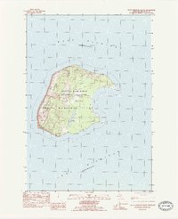
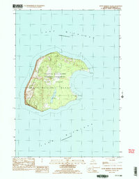
1983 Map of South Manitou Island
USGS Topo · Published 1984About this map
South Manitou Island sits isolated within Lake Michigan, showing the landform as it appeared in the early 1980s under the administration of the Sleeping Bear Dunes National Lakeshore. The island is defined by its striking topography, most notably the massive Perched Dunes that rise along the western shore. Evidence of the island's maritime history and past habitation is clear, from the S Manitou Lighthouse on the eastern shore at Sandy Point to a recorded Shipwreck off the southern coast.
Find a feature on this map
15 named features on this map. Tap any name to fly to it.
Don’t see what you’re looking for? This feature index may not catch every label — zoom into the map to look around manually.
Map Details
Editions of this 1983 South Manitou Island Map
3 editions found
Other maps of this area

1954 · Escanaba
USGS Topo · 1:250,000

1954 · Manitowoc
USGS Topo · 1:250,000

1956 · North Manitou
USGS Topo · 1:62,500

1957 · Escanaba
USGS Topo · 1:250,000

1957 · Empire
USGS Topo · 1:62,500

1958 · Escanaba
USGS Topo · 1:250,000

1958 · Manitowoc
USGS Topo · 1:250,000
1983 · Glen Haven
USGS Topo · 1:25,000
1983 · North Manitou Island
USGS Topo · 1:25,000
1983 · South Manitou Island
USGS Topo · 1:24,000