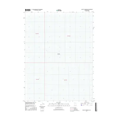
2017 Map of South of Arinosa SW
USGS Topo · Published 2017About this map
The Great Salt Lake Desert dominates this 2017 survey of Tooele County, Utah, where the arid landscape is defined by its extreme flatness and lack of surface features. The map illustrates the vast, unyielding character of the western desert, where surveyor lines of the Public Land Survey System—including t4s r17w, t4s r16w, t5s r17w, and t5s r16w—provide the only markers of human organization across the salt-crusted terrain. This specific sheet captures a section of the salt flats before any major infrastructure or significant development altered the natural topography, serving as a clean record of one of North America's most singular environments.
Find a feature on this map
5 named features on this map. Tap any name to fly to it.
Don’t see what you’re looking for? This feature index may not catch every label — zoom into the map to look around manually.
Map Details
Editions of this 2017 South of Arinosa SW Map
This is the sole edition of this map. No revisions or reprints were ever made.
Other maps of this area

1953 · Tooele
USGS Topo · 1:250,000

1955 · Tooele
USGS Topo · 1:250,000
1972 · Elephant Knoll NE
USGS Topo · 1:24,000

1972 · Elephant Knoll SE
USGS Topo · 1:24,000

1973 · Arinosa SE
USGS Topo · 1:24,000

1973 · Arinosa SW
USGS Topo · 1:24,000

1973 · Salduro SE
USGS Topo · 1:24,000

1973 · Gold Hill 1 SE
USGS Topo · 1:24,000

1973 · Gold Hill 1 SW
USGS Topo · 1:24,000

1973 · Gold Hill 1 NE
USGS Topo · 1:24,000