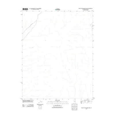
2012 Map of South of Delamar Lake
USGS Topo · Published 2012About this map
Pahranagat Wash defines the drainage of this arid landscape in Lincoln County, Nevada, where it meanders through a desert basin of intermittent watercourses. In this 2012 survey, the terrain is sparsely marked, primarily by the Power Line Maintenance Rd that cuts across the northwestern portion of the map. This utility road serves as the primary modern intervention in an otherwise undeveloped area south of the Delamar Lake basin. The map illustrates a transitional desert floor where natural hydrological features like the wash dictate the physical layout, providing a focused look at the topography and natural drainage patterns of this specific Nevada corridor before any further infrastructure was established.
Find a feature on this map
2 named features on this map. Tap any name to fly to it.
Don’t see what you’re looking for? This feature index may not catch every label — zoom into the map to look around manually.
Map Details
Editions of this 2012 South of Delamar Lake Map
This is the sole edition of this map. No revisions or reprints were ever made.
Other maps of this area

1885 · Pioche
USGS Topo · 1:250,000

1886 · Pioche
USGS Topo · 1:250,000

1945 · Alamo
USGS Topo · 1:125,000

1954 · Caliente
USGS Topo · 1:250,000

1959 · Caliente
USGS Topo · 1:250,000

1969 · Alamo SE
USGS Topo · 1:24,000
1969 · Delamar 3 SE
USGS Topo · 1:24,000

1969 · Gregerson Basin
USGS Topo · 1:24,000

1969 · Delamar 3 NE
USGS Topo · 1:24,000
1969 · Delamar 3 SW
USGS Topo · 1:24,000