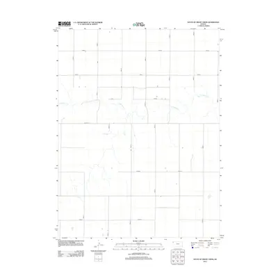
2012 Map of South of Drury Creek
USGS Topo · Published 2012About this map
Little Beaver Cr meanders across this rural landscape in Sherman County, forming the primary drainage in an area otherwise dominated by the rigid geometric precision of the Public Land Survey System. The map illustrates a high-plains agricultural environment where transportation is defined by a strictly organized grid of section-line roads, including Road 12, Road 14, and Road D. This systematic layout reflects the late-century evolution of the Kansas plains, where land use was partitioned into square-mile sections for farming and ranching. The southern edge is defined by Road 76, while Co Line Rd marks a significant boundary in the local transit network. The sparse distribution of structures alongside these thoroughfares highlights the vast, low-density settlement pattern characteristic of Western Kansas during the early twenty-first century.
Find a feature on this map
14 named features on this map. Tap any name to fly to it.
Don’t see what you’re looking for? This feature index may not catch every label — zoom into the map to look around manually.
Map Details
Editions of this 2012 South of Drury Creek Map
This is the sole edition of this map. No revisions or reprints were ever made.
Other maps of this area

1951 · Bird City South
USGS Topo · 1:62,500

1952 · St Francis 3
USGS Topo · 1:62,500

1954 · Goodland
USGS Topo · 1:250,000

1956 · Goodland
USGS Topo · 1:250,000

1957 · Goodland
USGS Topo · 1:250,000

1966 · Goodland NW
USGS Topo · 1:24,000

1966 · Ruleton NW
USGS Topo · 1:24,000

1966 · Ruleton NE
USGS Topo · 1:24,000
1978 · Crosby Creek
USGS Topo · 1:24,000
1978 · St. Francis 3 SE
USGS Topo · 1:24,000