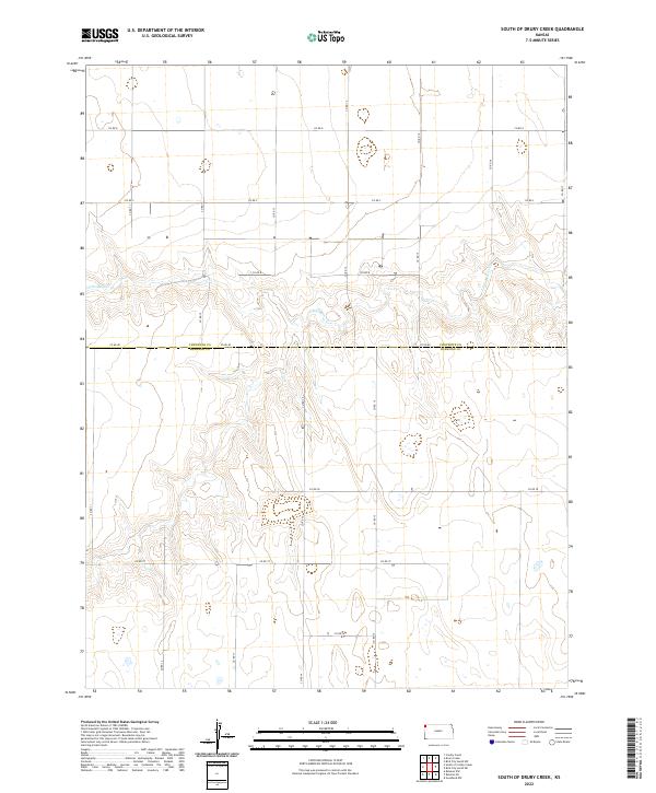
2022 Map of South of Drury Creek
USGS Topo · Published 2022About this map
Cheyenne and Sherman County lines divide this high plains landscape, where the seasonal drainage of Little Beaver Cr cuts a winding path through the semi-arid terrain of western Kansas. The survey highlights a strictly organized section-line grid of rural roads, including Co Rd 80 and Co Rd D, which provide the primary framework for the scattered agricultural activity in the region. Unlike more densely settled areas, this map reveals a landscape defined by its openness and the deliberate geometry of its land divisions, such as those within t5s r40w and t6s r41w. The subtle topography is marked by the branching tributaries of the creek, which offer the only major break in the wide, upland expanses of the High Plains.
Find a feature on this map
20 named features on this map. Tap any name to fly to it.
Don’t see what you’re looking for? This feature index may not catch every label — zoom into the map to look around manually.
Map Details
Editions of this 2022 South of Drury Creek Map
This is the sole edition of this map. No revisions or reprints were ever made.
Other maps of this area

1951 · Bird City South
USGS Topo · 1:62,500

1952 · St Francis 3
USGS Topo · 1:62,500

1954 · Goodland
USGS Topo · 1:250,000

1956 · Goodland
USGS Topo · 1:250,000

1957 · Goodland
USGS Topo · 1:250,000

1966 · Goodland NW
USGS Topo · 1:24,000

1966 · Ruleton NW
USGS Topo · 1:24,000

1966 · Ruleton NE
USGS Topo · 1:24,000
1978 · Crosby Creek
USGS Topo · 1:24,000
1978 · St. Francis 3 SE
USGS Topo · 1:24,000