
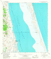
1952 Map of South of Potrero Lopeno
USGS Topo · Published 1957About this map
The settlement at Port Mansfield stands as the primary hub on this coastal landscape, situated along the edge of the Laguna Madre and protected by the long stretch of Padre Island. Inland, the terrain is defined by an extensive series of artesian wells and named water points such as Mujeres Wells, El Medio Wells, and Agua Gorda Well, reflecting the critical importance of reliable water sources in this salt-swept ranching environment.
Find a feature on this map
57 named features on this map. Tap any name to fly to it.
Don’t see what you’re looking for? This feature index may not catch every label — zoom into the map to look around manually.
Map Details
Editions of this 1952 South of Potrero Lopeno Map
2 editions found
Other maps of this area

1921 · Tarida Ranch
USGS Topo · 1:62,500

1923 · Lopena Island
USGS Topo · 1:62,500

1923 · Saltillo Ranch
USGS Topo · 1:62,500

1951 · South of Potrero Lopeno NE
USGS Topo · 1:24,000

1952 · Green Island
USGS Topo · 1:24,000

1952 · Potrero Lopeno SE
USGS Topo · 1:24,000

1952 · South of Potrero Lopeno NW
USGS Topo · 1:24,000
1952 · North Of Port Isabel NW
USGS Topo · 1:24,000

1952 · South of Potrero Lopeno SE
USGS Topo · 1:24,000

1952 · Hawk Island
USGS Topo · 1:24,000