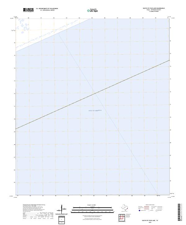
2025 Map of South of Star Lake
USGS Topo · Published 2025About this map
Gulf of America dominates this coastal study within Jefferson County, Texas. This 2025 survey serves primarily as a hydrographic record of the offshore environment, reflecting the vast maritime expanse of the Texas shoreline. The map is notably sparse in terrestrial detail, focusing instead on the open waters south of the mainland. A primary feature is the offshore boundary line, which marks the transition through the southern coastal waters of the Gulf. Because elevation data for this specific area did not meet standard accuracy requirements, contours are notably absent, emphasizing the map's role as a clear record of the maritime boundary and the coastal shelf during the early twenty-first century.
Find a feature on this map
1 named feature on this map. Tap any name to fly to it.
Don’t see what you’re looking for? This feature index may not catch every label — zoom into the map to look around manually.
Map Details
Editions of this 2025 South of Star Lake Map
This is the sole edition of this map. No revisions or reprints were ever made.
Other maps of this area

1950 · Houston
USGS Topo · 1:250,000

1956 · Houston
USGS Topo · 1:250,000

1961 · Star Lake
USGS Topo · 1:24,000

1961 · Mud Lake
USGS Topo · 1:24,000
1961 · Clam Lake
USGS Topo · 1:24,000
1962 · Whites Ranch
USGS Topo · 1:24,000
1962 · South of Star Lake
USGS Topo · 1:24,000

1975 · Houston
USGS Topo · 1:250,000
1983 · Galveston
USGS Topo · 1:100,000
1983 · Anahuac
USGS Topo · 1:100,000