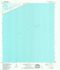
1994 Map of South of Star Lake
USGS Topo · Published 1994About this map
Mc Faddin National Wildlife Refuge dominates the upper-left corner of this coastal survey, where the Texas shoreline meets the vast expanse of the Gulf of Mexico. Compiled from 1960s planimetry and revised with late-1980s aerial photography, the map documents a sparse marshland environment defined by industrial and maritime infrastructure. A single road, 87, traces the thin strip of land between the wetlands and the sea. The presence of an Oil Well, a Pipeline, a Radio Tower, and a Heliport reflects the offshore energy economy's footprint on the Jefferson County coast. This mid-1990s edition is particularly useful for tracking shoreline changes, as it establishes the approximate line of mean high water during an era when the mean tidal range was recorded at approximately one foot.
Find a feature on this map
7 named features on this map. Tap any name to fly to it.
Don’t see what you’re looking for? This feature index may not catch every label — zoom into the map to look around manually.
Map Details
Editions of this 1994 South of Star Lake Map
This is the sole edition of this map. No revisions or reprints were ever made.
Other maps of this area

1950 · Houston
USGS Topo · 1:250,000

1956 · Houston
USGS Topo · 1:250,000

1961 · Star Lake
USGS Topo · 1:24,000

1961 · Mud Lake
USGS Topo · 1:24,000
1961 · Clam Lake
USGS Topo · 1:24,000
1962 · Whites Ranch
USGS Topo · 1:24,000
1962 · South of Star Lake
USGS Topo · 1:24,000

1975 · Houston
USGS Topo · 1:250,000
1983 · Galveston
USGS Topo · 1:100,000
1983 · Anahuac
USGS Topo · 1:100,000