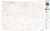
1984 Map of South Pass
USGS Topo · Published 1984About this map
Emigrant Trail tracks across this high-desert landscape in the mid-1980s, following the historic path through the Continental Divide between the Wind River Range and the vast Great Divide Basin. This survey captures the region as it balanced a legacy of westward migration with industrial resource extraction, notably at the Atlantic City Mine and Franklin Mine. The terrain is defined by dramatic geological features such as the Cyclone Rim, Honeycomb Buttes, and Oregon Buttes, which provided essential landmarks for travelers long before modern infrastructure like the U.S. Steel Road appeared.
Find a feature on this map
38 named features on this map. Tap any name to fly to it.
Don’t see what you’re looking for? This feature index may not catch every label — zoom into the map to look around manually.
Map Details
Editions of this 1984 South Pass Map
2 editions found
Other maps of this area

1951 · Soap Holes
USGS Topo · 1:24,000

1951 · Graham Ranch
USGS Topo · 1:24,000

1951 · Crooks Mountain
USGS Topo · 1:24,000

1951 · Myers Ranch
USGS Topo · 1:24,000

1953 · Lewiston Lakes
USGS Topo · 1:24,000

1953 · Barras Springs
USGS Topo · 1:24,000

1953 · Sweetwater Station
USGS Topo · 1:24,000

1953 · Gravel Spring
USGS Topo · 1:24,000

1953 · Happy Spring
USGS Topo · 1:24,000

1953 · Radium Springs
USGS Topo · 1:24,000
Featured Places
- Atlantic City, WY
- South Pass City, WY
- Erramouspe Place, WY
- Last Crossing Ford Number 9, WY
- Rocky Crossing, WY