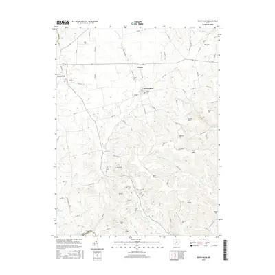
2016 Map of South Salem
USGS Topo · Published 2016About this map
Buckskin Creek and its many tributaries carve through this corner of the Ohio landscape, defining the character of small settlements like South Salem and Lyndon. The area is marked by significant topographical variation, where the stream valleys contrast with prominent elevations such as Nevins Hill, Edginton Hill, and Bald Knob. This 2016 survey captures a rural environment where land use is dictated by the drainage patterns of Upper Twin Cr and Lower Twin Cr, while Paint Creek Lake touches the southwestern corner. Genealogists will find a wealth of local history preserved in the numerous family and community burial grounds scattered across the townships, including the Old Stone Cem near Thrifton and the Hymiller Cem in the vicinity of Humboldt. The infrastructure is characterized by a network of county highways and township roads that connect these agricultural hubs, with Buckskin Bridge serving as a local landmark.
Find a feature on this map
98 named features on this map. Tap any name to fly to it.
Don’t see what you’re looking for? This feature index may not catch every label — zoom into the map to look around manually.
Map Details
Editions of this 2016 South Salem Map
This is the sole edition of this map. No revisions or reprints were ever made.
Other maps of this area

1912 · Roxabell
USGS Topo · 1:62,500

1914 · Roxabell
USGS Topo · 1:62,500

1915 · Bainbridge
USGS Topo · 1:48,000

1915 · Piketon
USGS Topo · 1:62,500

1917 · Bainbridge
USGS Topo · 1:62,500

1917 · Piketon
USGS Topo · 1:62,500

1917 · Greenfield
USGS Topo · 1:62,500

1944 · Piketon
USGS Topo · 1:62,500

1944 · Greenfield
USGS Topo · 1:62,500

1944 · Roxabell
USGS Topo · 1:62,500