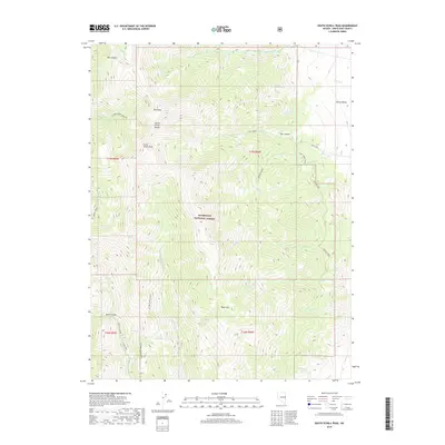
2018 Map of South Schell Peak
USGS Topo · Published 2018About this map
South Schell Peak dominates this high-altitude landscape in the Schell Creek Range, where steep elevation gradients define the local geography. Located within the Humboldt National Forest, the area serves as a significant drainage basin for numerous creeks, including Taft Creek and Stephens Creek, which flow through deep incisions like Taft Canyon.
Find a feature on this map
41 named features on this map. Tap any name to fly to it.
Don’t see what you’re looking for? This feature index may not catch every label — zoom into the map to look around manually.
Map Details
Editions of this 2018 South Schell Peak Map
This is the sole edition of this map. No revisions or reprints were ever made.
Other maps of this area

1952 · Ely
USGS Topo · 1:125,000

1956 · Ely
USGS Topo · 1:250,000

1959 · Ely
USGS Topo · 1:250,000

1959 · Sacramento Pass
USGS Topo · 1:62,500

1959 · Connors Pass
USGS Topo · 1:62,500

1959 · Schell Peaks
USGS Topo · 1:62,500

1963 · Ely
USGS Topo · 1:250,000

1981 · North Schell Peak
USGS Topo · 1:24,000

1981 · Duck Creek Valley
USGS Topo · 1:24,000
1981 · South Schell Peak
USGS Topo · 1:24,000