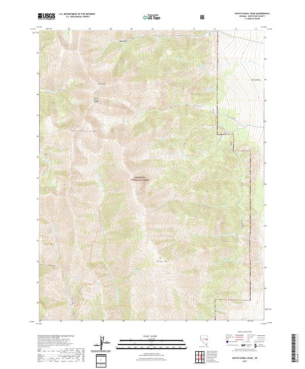
2021 Map of South Schell Peak
USGS Topo · Published 2021About this map
The high ridges of the Schell Creek Range dominate this part of the Humboldt National Forest, where the terrain climbs toward the prominent heights of Taft Peak and South Schell Peak. This high-elevation landscape is defined by its drainage systems, including Timber Cr and Taft Cr, which flow through steep corridors like Taft Canyon. A network of trails, such as the North Fork Berry Creek Trl and Kraft Canyon Trl, provides the primary access through the forest and canyons.
Find a feature on this map
39 named features on this map. Tap any name to fly to it.
Don’t see what you’re looking for? This feature index may not catch every label — zoom into the map to look around manually.
Map Details
Editions of this 2021 South Schell Peak Map
This is the sole edition of this map. No revisions or reprints were ever made.
Other maps of this area

1952 · Ely
USGS Topo · 1:125,000

1956 · Ely
USGS Topo · 1:250,000

1959 · Ely
USGS Topo · 1:250,000

1959 · Sacramento Pass
USGS Topo · 1:62,500

1959 · Connors Pass
USGS Topo · 1:62,500

1959 · Schell Peaks
USGS Topo · 1:62,500

1963 · Ely
USGS Topo · 1:250,000

1981 · North Schell Peak
USGS Topo · 1:24,000

1981 · Duck Creek Valley
USGS Topo · 1:24,000
1981 · South Schell Peak
USGS Topo · 1:24,000