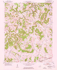
1951 Map of South Union
USGS Topo · Published 1977About this map
The Gasper River winds through the hills of Logan and Warren counties in this early 1950s survey, defining a landscape shaped by river crossings and rural gathering places. Historic river access is marked by Buffalo Ford, Island Ford, and Rock House Ford, while the community of South Union serves as a southern anchor along the Louisville and Nashville railroad line. The map highlights the area's religious and educational foundations, including St Maur Sch, New Harmony Ch, and Cave Spring Ch, which includes its own Cave Spring Ch Cem. Family and community history is etched into the terrain through various landmarks like Felts Cem and the small settlement of Liberty. The presence of several oil wells in the northern reaches near Epperson Hollow Creek suggests early 20th-century resource extraction alongside the established agricultural character of the Gasper region.
Find a feature on this map
33 named features on this map. Tap any name to fly to it.
Don’t see what you’re looking for? This feature index may not catch every label — zoom into the map to look around manually.
Map Details
Editions of this 1951 South Union Map
2 editions found
Other maps of this area

1911 · Dunmor
USGS Topo · 1:48,000

1914 · Little Muddy
USGS Topo · 1:62,500

1914 · Dunmor
USGS Topo · 1:62,500

1951 · Woodburn
USGS Topo · 1:24,000

1951 · Auburn
USGS Topo · 1:24,000

1951 · South Union
USGS Topo · 1:24,000

1951 · Homer
USGS Topo · 1:24,000

1952 · Dennis
USGS Topo · 1:24,000

1952 · Rockfield
USGS Topo · 1:24,000

1953 · Quality
USGS Topo · 1:24,000