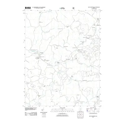
2011 Map of South Webster
USGS Topo · Published 2011About this map
South Webster anchors this 2011 survey of southern Ohio, where the local economy and geography remain deeply tied to its industrial and agricultural roots. The map documents a landscape carved by numerous watercourses, including Hales Creek, Bloom Furnace Creek, and Pine Creek, which wind through a series of named hollows such as Slab Hollow and Diamond Hollow. These valleys often served as the sites for early settlements and industry, evidenced by the presence of Firebrick and Olive Furnace.
Find a feature on this map
87 named features on this map. Tap any name to fly to it.
Don’t see what you’re looking for? This feature index may not catch every label — zoom into the map to look around manually.
Map Details
Editions of this 2011 South Webster Map
This is the sole edition of this map. No revisions or reprints were ever made.
Other maps of this area

1898 · Ironton
USGS Topo · 1:62,500

1900 · Ironton
USGS Topo · 1:62,500

1911 · Sciotoville
USGS Topo · 1:62,500

1912 · Oak Hill
USGS Topo · 1:62,500

1913 · Sciotoville
USGS Topo · 1:62,500

1926 · Greenup
USGS Topo · 1:48,000

1930 · Greenup
USGS Topo · 1:62,500

1957 · Huntington
USGS Topo · 1:250,000

1960 · Huntington
USGS Topo · 1:250,000
1961 · Petersburg
USGS Topo · 1:24,000