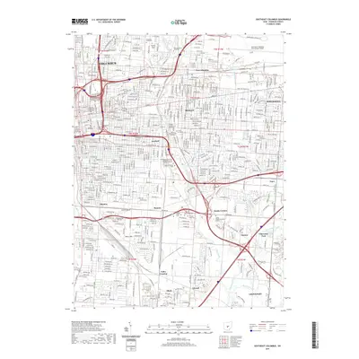
2019 Map of Southeast Columbus
USGS Topo · Published 2019About this map
Columbus and its eastern suburbs are deeply defined by a complex intersection of academic institutions, historic transit corridors, and industrial infrastructure. The landscape is anchored by numerous centers of higher learning, including Ohio Dominican University to the north and the cluster of Capital University, Bexley Hall Episcopal Seminary, and Trinity Lutheran Seminary in Bexley. These educational centers sit alongside significant religious sites such as Evergreen Burial Park and a collection of cemeteries including Agudas Achim Cem and Beth Jacob Cem.
Find a feature on this map
57 named features on this map. Tap any name to fly to it.
Don’t see what you’re looking for? This feature index may not catch every label — zoom into the map to look around manually.
Map Details
Editions of this 2019 Southeast Columbus Map
This is the sole edition of this map. No revisions or reprints were ever made.
Other maps of this area

1901 · Dublin
USGS Topo · 1:62,500

1902 · Westerville
USGS Topo · 1:62,500

1903 · Dublin
USGS Topo · 1:62,500

1904 · Westerville
USGS Topo · 1:62,500

1923 · West Columbus
USGS Topo · 1:62,500

1925 · East Columbus
USGS Topo · 1:62,500

1925 · West Columbus
USGS Topo · 1:62,500

1943 · East Columbus
USGS Topo · 1:62,500

1947 · Columbus
USGS Topo · 1:250,000

1950 · Marion
USGS Topo · 1:250,000