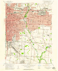
1955 Map of Southeast Columbus
USGS Topo · Published 1957About this map
Columbus serves as a dense educational and religious hub in the mid-1950s, with a concentration of parochial schools and institutions like St Joseph Academy and St Mary of the Springs College. The city's eastern expansion is clearly marked by the incorporated enclaves of Bexley and Whitehall, while the surrounding landscape transitions into the industrial and transit corridors of Steelton and Valley Crossing. A complex network of railroads, including the Pennsylvania and Chesapeake and Ohio, facilitates movement through the Alum Creek valley, connecting the urban core to rural junctions.
Find a feature on this map
137 named features on this map. Tap any name to fly to it.
Don’t see what you’re looking for? This feature index may not catch every label — zoom into the map to look around manually.
Map Details
Editions of this 1955 Southeast Columbus Map
This is the sole edition of this map. No revisions or reprints were ever made.
Other maps of this area

1901 · Dublin
USGS Topo · 1:62,500

1902 · Westerville
USGS Topo · 1:62,500

1903 · Dublin
USGS Topo · 1:62,500

1904 · Westerville
USGS Topo · 1:62,500

1923 · West Columbus
USGS Topo · 1:62,500

1925 · East Columbus
USGS Topo · 1:62,500

1925 · West Columbus
USGS Topo · 1:62,500

1943 · East Columbus
USGS Topo · 1:62,500

1947 · Columbus
USGS Topo · 1:250,000

1950 · Marion
USGS Topo · 1:250,000