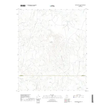
2019 Map of Southerland Canyon
USGS Topo · Published 2019About this map
Haystack Brine Springs and Salt Flat Brine Spring define the saline hydrology of this West Texas landscape along the border of King and Stonewall counties. The terrain is characterized by deeply eroded drainage systems, including Haystack Canyon and Southerland Canyon, which cut through the high plains toward the Salt Croton Cr. This area is marked by unique geographical features like the Salt Flat and Haystack Mtn, suggesting a mineral-rich environment where water sources are often brackish. Ranching infrastructure is evident through named water bodies such as Bar S Ranch Lake and South Tank, while a network of county roads like Co RD 448 provides access through the rugged breaks. The convergence of numerous intermittent streams, such as Dove Cr and Salt Cr, illustrates the complex watershed that feeds into the larger Croton Creek system.
Find a feature on this map
23 named features on this map. Tap any name to fly to it.
Don’t see what you’re looking for? This feature index may not catch every label — zoom into the map to look around manually.
Map Details
Editions of this 2019 Southerland Canyon Map
This is the sole edition of this map. No revisions or reprints were ever made.
Other maps of this area

1954 · Lubbock
USGS Topo · 1:250,000

1958 · Pursley House
USGS Topo · 1:24,000

1958 · Southerland Canyon
USGS Topo · 1:24,000

1958 · Seven Diamond L Canyon
USGS Topo · 1:24,000

1958 · Lovers Resort
USGS Topo · 1:24,000

1958 · Jayton
USGS Topo · 1:24,000

1959 · Bob Creek
USGS Topo · 1:24,000

1968 · Pitchfork Ranch
USGS Topo · 1:24,000

1968 · Guthrie
USGS Topo · 1:24,000

1968 · Pitchfork Flats
USGS Topo · 1:24,000