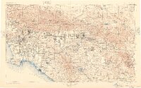
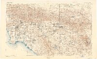
1901 Map of Southern California Sheet No. 1
USGS Topo · Published 1948About this map
Los Angeles and its emerging suburbs sit at the center of a massive transit web at the end of the 19th century, before the era of major freeway construction. This survey captures the region's early reliance on rail, showing the intricate networks of the Southern Pacific RR and the Pacific Electric Ry connecting coastal towns like Santa Monica and Long Beach to the inland citrus hubs of Riverside and San Bernardino. Beyond the developing plains, the topography rises sharply into the San Gabriel Mountains and San Bernardino Mountains, where landmarks like Mount Wilson and Bear Lake dominate the skyline. The map also delineates several tribal lands, including the Coahuila Indian Reservation and Morongo Indian Reservation, providing a detailed look at land division and water resources like Elsinore Lake and the Santa Ana River during a period of rapid southern expansion.
Find a feature on this map
169 named features on this map. Tap any name to fly to it.
Don’t see what you’re looking for? This feature index may not catch every label — zoom into the map to look around manually.
Map Details
Editions of this 1901 Southern California Sheet No. 1 Map
6 editions found

Other maps of this area

1894 · Los Angeles
USGS Topo · 1:62,500

1894 · Pomona
USGS Topo · 1:62,500

1896 · Santa Ana
USGS Topo · 1:62,500

1896 · Pasadena
USGS Topo · 1:62,500

1896 · Anaheim
USGS Topo · 1:62,500

1896 · Redondo
USGS Topo · 1:62,500

1896 · San Bernardino
USGS Topo · 1:62,500

1896 · Las Bolsas
USGS Topo · 1:62,500

1896 · Santa Monica
USGS Topo · 1:62,500

1896 · San Pedro
USGS Topo · 1:62,500