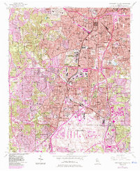
1954 Map of Southwest Atlanta
USGS Topo · Published 1983About this map
Westview and the surrounding urban sprawl of southwest Atlanta dominate this mid-century landscape, captured during a period of significant municipal expansion. The map detail highlights a dense network of educational and religious institutions, from the South Side High School to numerous neighborhood churches like Ladd Street Ch and Bethel Ch. Extensive industrial and transportation infrastructure is evident, with the massive Hartsfield-Atlanta International Airport occupying the southern portion of the sheet.
Find a feature on this map
76 named features on this map. Tap any name to fly to it.
Don’t see what you’re looking for? This feature index may not catch every label — zoom into the map to look around manually.
Map Details
Editions of this 1954 Southwest Atlanta Map
5 editions found

Other maps of this area

1888 · Atlanta
USGS Topo · 1:125,000

1890 · Atlanta
USGS Topo · 1:125,000

1891 · Marietta
USGS Topo · 1:125,000

1892 · Atlanta
USGS Topo · 1:125,000

1895 · Atlanta
USGS Topo · 1:125,000

1895 · Marietta
USGS Topo · 1:125,000

1897 · Marietta
USGS Topo · 1:125,000

1901 · Marietta
USGS Topo · 1:125,000

1953 · Atlanta
USGS Topo · 1:250,000

1954 · Conley
USGS Topo · 1:24,000