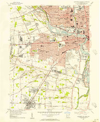
1955 Map of Southwest Columbus
USGS Topo · Published 1956About this map
The Scioto River snakes through the heart of Franklin County, defining a mid-century landscape of heavy industry, state institutions, and expanding neighborhoods. The urban core of Columbus is marked by significant landmarks like the Ohio State Penitentiary and the expansive grounds of the Columbus State Hospital. To the south and west, the map captures the transition from dense city wards to suburbanizing areas such as Grandview Heights and Upper Arlington.
Find a feature on this map
77 named features on this map. Tap any name to fly to it.
Don’t see what you’re looking for? This feature index may not catch every label — zoom into the map to look around manually.
Map Details
Editions of this 1955 Southwest Columbus Map
This is the sole edition of this map. No revisions or reprints were ever made.
Other maps of this area

1901 · Dublin
USGS Topo · 1:62,500

1902 · Westerville
USGS Topo · 1:62,500

1903 · Dublin
USGS Topo · 1:62,500

1904 · Westerville
USGS Topo · 1:62,500

1923 · West Columbus
USGS Topo · 1:62,500

1925 · East Columbus
USGS Topo · 1:62,500

1925 · West Columbus
USGS Topo · 1:62,500

1943 · East Columbus
USGS Topo · 1:62,500

1947 · Columbus
USGS Topo · 1:250,000

1950 · Marion
USGS Topo · 1:250,000