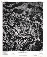
1976 Map of Southwest Lumberton
USGS Topo · Published 1976About this map
Lumberton serves as the focal point for this orthophotoquad, which utilizes imagery from the Department of Natural and Economic Resources to reveal the mid-1970s landscape of Robeson County. The aerial perspective captures a transitional moment for the region, where the organized grid of the city meets an extensive network of drainage basins and agricultural plots. Dense wooded corridors follow the natural winding of local watercourses, contrasting sharply with the geometric clearing of fields and the expansion of residential developments like East Side Park. In the southwestern corner, the outskirts of Fairmont are visible, connected to the county seat by a developing infrastructure of highways and rural roads. This photographic record is particularly valuable for documenting the exact footprint of forest cover and land use before subsequent decades of development altered the outskirts of these North Carolina communities.
Find a feature on this map
3 named features on this map. Tap any name to fly to it.
Don’t see what you’re looking for? This feature index may not catch every label — zoom into the map to look around manually.
Map Details
Editions of this 1976 Southwest Lumberton Map
This is the sole edition of this map. No revisions or reprints were ever made.
Other maps of this area

1943 · Pages Mill
USGS Topo · 1:62,500

1953 · Chadbourn
USGS Topo · 1:62,500

1953 · Florence
USGS Topo · 1:250,000

1954 · Florence
USGS Topo · 1:250,000

1957 · Bladenboro
USGS Topo · 1:62,500

1962 · Fairmont
USGS Topo · 1:24,000

1962 · Gaddysville
USGS Topo · 1:24,000

1962 · Fair Bluff
USGS Topo · 1:62,500

1972 · Northwest Lumberton
USGS Topo · 1:24,000

1972 · Southwest Lumberton
USGS Topo · 1:24,000