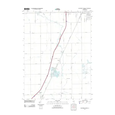
2012 Map of Southwest Pontiac
USGS Topo · Published 2012About this map
The settlement of Ocoya serves as a central anchor in this Livingston County landscape, situated along the corridor of Historic Hwy 66. This alignment, also labeled as Old Route 66 and Old Hwy 66, cuts diagonally across a grid of rural roads and agrarian plots. The terrain is defined by the winding paths of Rooks Cr, Pike Cr, and Turtle Cr, which create natural deviations in the otherwise orderly section lines. Genealogists will find several burial sites noted, including Calvary Catholic Cem, Book's Creek Cem, and Payne Cem. Aviation history is also represented by small local facilities such as Seeman Airport and the Harris Landing Strip, reflecting the integration of private flight into the regional infrastructure. In the northern reaches, the edges of Belmont and the Pontiac Municipal area begin to transition into the more developed outskirts of the county seat.
Find a feature on this map
56 named features on this map. Tap any name to fly to it.
Don’t see what you’re looking for? This feature index may not catch every label — zoom into the map to look around manually.
Map Details
Editions of this 2012 Southwest Pontiac Map
This is the sole edition of this map. No revisions or reprints were ever made.
Other maps of this area

1926 · Normal
USGS Topo · 1:62,500

1930 · Normal
USGS Topo · 1:62,500

1935 · Pontiac
USGS Topo · 1:62,500

1939 · Pontiac
USGS Topo · 1:62,500

1957 · Colfax
USGS Topo · 1:62,500

1958 · Flanagan
USGS Topo · 1:62,500

1958 · Peoria
USGS Topo · 1:250,000

1961 · Peoria
USGS Topo · 1:250,000

1963 · Peoria
USGS Topo · 1:250,000

1981 · Lexington
USGS Topo · 1:24,000