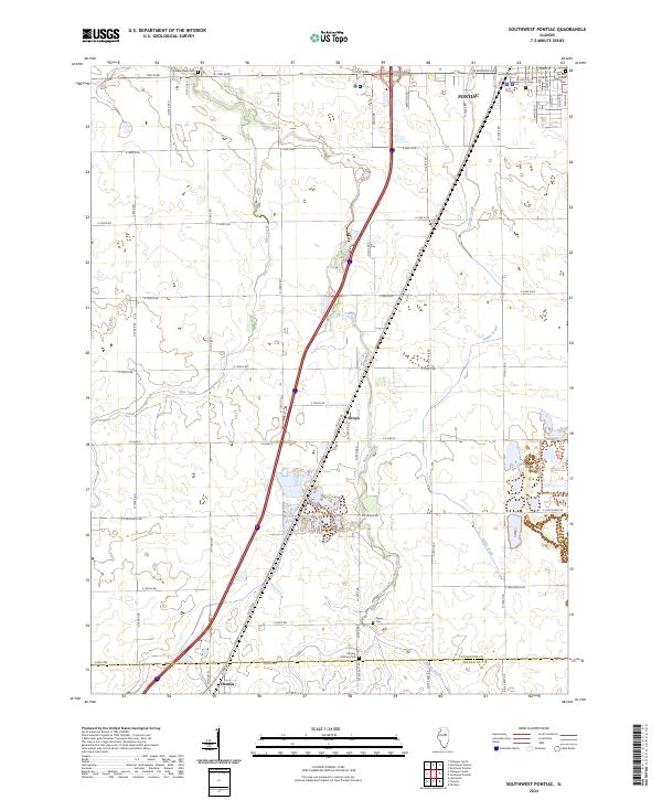
2024 Map of Southwest Pontiac
USGS Topo · Published 2024About this map
The agricultural landscape south of Pontiac is defined by the winding paths of Rooks Creek, Pike Creek, and Turtle Creek. This contemporary survey shows the enduring geometry of the Illinois prairie, where the section-line road grid is occasionally broken by the diagonal corridor of Old Rte 66. The small settlement of Ocoya sits near the center of the sheet, serving as a landmark along the transit routes that connect the larger centers of Pontiac to the north and Chenoa at the southern margin. Local history and genealogy researchers will find several well-preserved burial grounds including Rooks Creek Cem, Payne Cem, and Calvary Catholic Cem, which sit alongside the county line between Livingston and McLean counties. The map provides a precise look at the modern rural residential patterns and the intricate drainage network that supports the region's productive farmland.
Find a feature on this map
54 named features on this map. Tap any name to fly to it.
Don’t see what you’re looking for? This feature index may not catch every label — zoom into the map to look around manually.
Map Details
Editions of this 2024 Southwest Pontiac Map
This is the sole edition of this map. No revisions or reprints were ever made.
Other maps of this area

1926 · Normal
USGS Topo · 1:62,500

1930 · Normal
USGS Topo · 1:62,500

1935 · Pontiac
USGS Topo · 1:62,500

1939 · Pontiac
USGS Topo · 1:62,500

1957 · Colfax
USGS Topo · 1:62,500

1958 · Flanagan
USGS Topo · 1:62,500

1958 · Peoria
USGS Topo · 1:250,000

1961 · Peoria
USGS Topo · 1:250,000

1963 · Peoria
USGS Topo · 1:250,000

1981 · Lexington
USGS Topo · 1:24,000