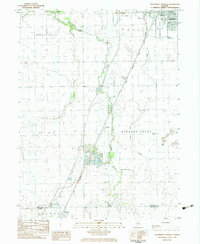
1983 Map of Southwest Pontiac
USGS Topo · Published 1983About this map
The State Correctional Center and the southern reaches of Pontiac anchor the northeastern corner of this Central Illinois landscape, where the agricultural grid is interrupted by the winding courses of Rooks Creek and Turtle Creek. The map documents a transportation-heavy corridor, with the Illinois Central Gulf railroad and several private airfields, including the Seeman Landing Strip and Harris Landing Strip, supporting the local economy. Further south, the small settlement of Ocoya sits near a significant Quarry operation, while the northern edge of Chenoa enters the frame at the McLean County border. Genealogists will find the City Cem, Calvary Cem, and Payne Cem clearly marked, alongside civic landmarks like Humiston Park and Lincoln Sch that define the community's mid-century footprint.
Find a feature on this map
27 named features on this map. Tap any name to fly to it.
Don’t see what you’re looking for? This feature index may not catch every label — zoom into the map to look around manually.
Map Details
Editions of this 1983 Southwest Pontiac Map
This is the sole edition of this map. No revisions or reprints were ever made.
Other maps of this area

1926 · Normal
USGS Topo · 1:62,500

1930 · Normal
USGS Topo · 1:62,500

1935 · Pontiac
USGS Topo · 1:62,500

1939 · Pontiac
USGS Topo · 1:62,500

1957 · Colfax
USGS Topo · 1:62,500

1958 · Flanagan
USGS Topo · 1:62,500

1958 · Peoria
USGS Topo · 1:250,000

1961 · Peoria
USGS Topo · 1:250,000

1963 · Peoria
USGS Topo · 1:250,000

1981 · Lexington
USGS Topo · 1:24,000