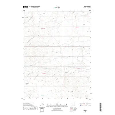
2019 Map of Sparks
USGS Topo · Published 2019About this map
Sparks serves as the focal point for this high-desert landscape in northwestern Colorado, situated along a network of county roads including Co RD 72. The terrain is defined by a complex system of drainage draws and ridges, including Diamond Field Draw and the interestingly named Hanging Tree Draw, which lead toward the bottomlands of Talamantes Cr. To the south, the elevation rises sharply toward Cold Spring Mtn and Limestone Ridge, marking a transition from the flats to more prominent upland features. Water management is evident through several small-scale features like the Fish Reservoirs, Arthurs Reservoir, and Coyote Spring, which are critical in this arid environment. The map also identifies localized landmarks such as Harry Holy Bottom and Diamond Field, providing a clear view of the ranching and geographical identifiers used in this portion of Moffat County during the early twenty-first century.
Find a feature on this map
36 named features on this map. Tap any name to fly to it.
Don’t see what you’re looking for? This feature index may not catch every label — zoom into the map to look around manually.
Map Details
Editions of this 2019 Sparks Map
This is the sole edition of this map. No revisions or reprints were ever made.
Other maps of this area

1954 · Lodore School
USGS Topo · 1:24,000

1954 · Vernal
USGS Topo · 1:250,000

1954 · Rock Springs
USGS Topo · 1:250,000

1958 · Vernal
USGS Topo · 1:250,000

1958 · Rock Springs
USGS Topo · 1:250,000

1960 · Vernal
USGS Topo · 1:250,000

1962 · Rock Springs
USGS Topo · 1:250,000

1963 · Four J Rim
USGS Topo · 1:24,000

1963 · Scrivner Butte
USGS Topo · 1:24,000

1966 · Sugarloaf Butte
USGS Topo · 1:24,000