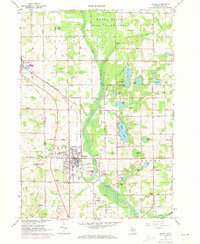
1967 Map of Sparta
USGS Topo · Published 1973About this map
The Rogue River State Game Area dominates the northern reaches of this Kent County landscape, where the Rogue River meanders through a valley defined by glacial topography and numerous kettle lakes. In the village of Sparta, the intersection of the Chesapeake and Ohio Railroad and the Grade provides a clear view of the town's industrial and residential footprint during the late 1960s, including the local High Sch, Middle Sch, and Sewage Disposal works. Further north, the smaller settlement of Kent City serves as a secondary hub near the edge of the Tyrone township line.
Find a feature on this map
69 named features on this map. Tap any name to fly to it.
Don’t see what you’re looking for? This feature index may not catch every label — zoom into the map to look around manually.
Map Details
Editions of this 1967 Sparta Map
2 editions found
Other maps of this area

1918 · Cedar Springs
USGS Topo · 1:62,500

1943 · Cedar Springs
USGS Topo · 1:62,500

1945 · Ravenna
USGS Topo · 1:62,500

1954 · Midland
USGS Topo · 1:250,000

1958 · Midland
USGS Topo · 1:250,000

1958 · Sand Lake
USGS Topo · 1:62,500

1958 · Fremont
USGS Topo · 1:62,500

1959 · Midland
USGS Topo · 1:250,000

1966 · Midland
USGS Topo · 1:250,000

1967 · Sparta
USGS Topo · 1:24,000