
1953 Map of Spartanburg
USGS Topo · Published 1966About this map
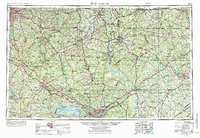
Columbia and Spartanburg anchor this mid-century look at the Piedmont and Sandhills regions, showing a landscape defined by industrial water management and expanding infrastructure. The impoundment of the Catawba River and the Saluda River is prominent, creating massive features like Lake Murray, Wateree Reservoir, and Fishing Creek Reservoir. These man-made water bodies contrast with the natural flow of the Broad River and Pee Dee River, which continue to shape the drainage of the Carolina interior.
Find a feature on this map
49 named features on this map. Tap any name to fly to it.
Don’t see what you’re looking for? This feature index may not catch every label — zoom into the map to look around manually.
Map Details
Editions of this 1953 Spartanburg Map
4 editions found
Other maps of this area

1892 · Mc Cormick
USGS Topo · 1:125,000

1892 · Abbeville
USGS Topo · 1:125,000

1904 · Columbia
USGS Topo · 1:125,000

1905 · Charlotte
USGS Topo · 1:48,000

1906 · Kings Mountain
USGS Topo · 1:62,500

1907 · Sharon
USGS Topo · 1:62,500

1907 · Saluda
USGS Topo · 1:125,000

1907 · Charlotte
USGS Topo · 1:62,500

1908 · Kings Mountain
USGS Topo · 1:62,500

1908 · Kirksey
USGS Topo · 1:24,000